Search Constraints
You searched for:
Format
GeoTIFF
Remove constraint Format: GeoTIFF
Place
Balkanhalbinsel
Remove constraint Place: Balkanhalbinsel
« Previous |
31 - 38 of 38
|
Next »
Search Results
31. Summary-map
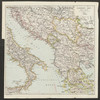
1913. Balkanhalbinsel and Italien. Versteckte Karten.
32. Types des maisons

1918. Balkanhalbinsel and Südosteuropa. Haus. Versteckte Karten.
33. Types des villages

1918. Balkanhalbinsel and Südosteuropa. Ländliche Siedlung. Versteckte Karten.
34. Types et variétés psychiques des Yougoslaves
1918. Balkanhalbinsel and Südosteuropa. Ethnische Gruppe. Ethnografie. Versteckte Karten.
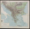
35. Völkerkarte der Balkanhalbinsel : mit statistisch-geographischem Begleittext
1919. Balkanhalbinsel. Ethnologie and Verbreitungskarte. 1919/1919. Versteckte Karten.
36. Voenno-dorožnaja karta časti Rossii i pograničnych zemelʹ

Šubert. Balkanhalbinsel and Osmanisches Reich.
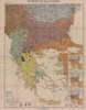
37. Zones de civilisation
1918. Balkanhalbinsel and Südosteuropa. Ethnische Gruppe. Ethnografie. Versteckte Karten.
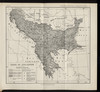
38. Zones de climat dans la peninsule balkanique
1918. Balkanhalbinsel and Südosteuropa. Geografie. Versteckte Karten.
- « Previous
- Next »
- 1
- 2
- 3
- 4