Search Constraints
You searched for:
Format
GeoTIFF
Remove constraint Format: GeoTIFF
Place
Balkanhalbinsel
Remove constraint Place: Balkanhalbinsel
1 - 38 of 38
Search Results
1. [Balkan]

1908. Bulgarien and Balkanhalbinsel. Versteckte Karten.
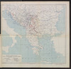
2. Balkanstaaten
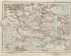
1913. Balkanhalbinsel. Eisenbahnnetz. 1913/1913. Eisenbahn. Versteckte Karten.
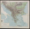
3. Übersichtskarte der Balkanhabinsel

1896. Balkanhalbinsel. 1916/1916. Versteckte Karten.
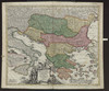
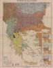
4. Übersichtskarte der Balkanländer und der anschließenden Gebiete
1915. Kaiserlich-Königliches Militär-Geographisches Institut. Balkanhalbinsel. Weltkrieg <1914-1918>. 1915/1915. Versteckte Karten.
5. Carte de la Péninsule des Balkans
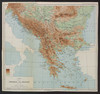
1918. Balkanhalbinsel and Südosteuropa. Versteckte Karten.
6. Carte ethnographique de la péninsule des Balkans
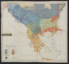
1918. Balkanhalbinsel and Südosteuropa. Ethnische Gruppe. Ethnografie. Versteckte Karten.
7. Courants métanastasiques dans le peuplement des pays Serbes du XVe siècle à nos jours
1918. Balkanhalbinsel and Südosteuropa. Migration. Migration. Versteckte Karten.
8. Danubii fluminis (hic ab urbe Belgrado, per Mare Nigrum usq Constantinopolim defluentis exhibiti) pars infima, in qua Transylvania, Walachia, Moldavia, Bulgaria, Servia, Romania et Bessarabia cum vicinis regionibus ostenduntur
1730. Homann, Johann Baptist . Balkanhalbinsel and Donau. Flusslauf.
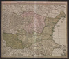
9. Die Balkanländer im Jahre 1876
1919. Balkanhalbinsel. 1876/1876. Versteckte Karten.
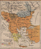
10. Die Balkanländer im Jahre 1912
1919. Balkanhalbinsel. 1912/1912. Versteckte Karten.
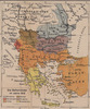
11. Die Balkanländer im Jahre 1914
1919. Balkanhalbinsel. 1914/1914. Versteckte Karten.
12. Fluviorum in Europa principis Danubii Cum Adiacentibus Regnis, nec non totius Graeciae Et Archipelagi Novißima Tabula
Homann, Johann Baptist . Balkanhalbinsel and Donau. Flusslauf.
13. Formes de la propriété rurale
1918. Balkanhalbinsel and Südosteuropa. Grundeigentum. Versteckte Karten.
14. G. Freytags Karte des Kriegsschauplatzes auf der Balkanhalbinsel
1917. Balkanhalbinsel and Osmanisches Reich. 1912/1912.
15. Karten zum russisch-türkischen Krieg 1877-1878. Europäische Türkei und Balkanstaaten bis zum Kriegsende

1939. Balkanhalbinsel. Russisch-Türkischer Krieg <1877-1878> . 1877/1878. Militärgeschichte. Versteckte Karten.
16. Karten zum russisch-türkischen Krieg 1877-1878. Europäische Türkei und Balkanstaaten nach dem Berliner Kongress
1939. Balkanhalbinsel. Russisch-Türkischer Krieg <1877-1878> and Berliner Kongress. 1878/1878. Militärgeschichte. Versteckte Karten.
17. La chaîne centrale d'après Ptolémée

1918. Balkanhalbinsel and Südosteuropa. Geografie and Ptolemaeus, Claudius. Versteckte Karten.
18. Libération et agrandissements successifs des états Balkaniques

1918. Balkanhalbinsel and Südosteuropa. Unabhängigkeitsbewegung. Versteckte Karten.
19. Ligne de partage d'après la carte annexée au traité d'alliance
1917. Balkanhalbinsel. Grenze and Balkankrieg <1912-1913>. 1912/1913. Versteckte Karten.
20. Map 4 : The plan of Calice (Austrian ambassador to Constantinople) from 1896
2021. Demeter, Gábor and Bottlik, Zsolt. Balkanhalbinsel. Großmachtpolitik and Calice, Heinrich von. 1896/1896. Ethnografie. Versteckte Karten.
21. Map 6 : A simplified ethnic map of the Balkans for Hungarian military officers
2021. Demeter, Gábor and Bottlik, Zsolt. Balkanhalbinsel. Ethnische Gruppe. 1913/1913. Ethnografie. Versteckte Karten.
22. Map 61 : Ethnic map of the Balkans in 1910 (based on Ottoman salname)
2021. Demeter, Gábor and Bottlik, Zsolt. Balkanhalbinsel. Ethnische Gruppe. 1910/1910. Ethnografie. Versteckte Karten.
23. Map 7 : The linguistic map of Belić in the Balkans
2021. Demeter, Gábor and Bottlik, Zsolt. Balkanhalbinsel. Dialekt and Belić, Aleksandar. 1910/1910. Ethnografie. Versteckte Karten.
24. Map 8 : a simplified sketch map of the evolution of Cvijic’s ideas
2021. Demeter, Gábor and Bottlik, Zsolt. Balkanhalbinsel. Ethnische Gruppe and Cvijić, Jovan. Ethnografie. Versteckte Karten.
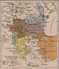
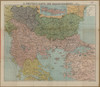
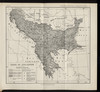
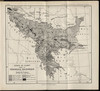
25. Map of the Balkan States
1923. Balkanhalbinsel. 1923/1923. Versteckte Karten.
26. Modifications territoriales dans le Balkans: Conférence de Londres ; Traité de Bukarest
1914. Balkanhalbinsel. Bukarest / Friede <1913> and Staatsgrenze. 1913/1913. Versteckte Karten.
27. Modifications territoriales dans le Balkans: Traité de Bukarest
1914. Balkanhalbinsel. Bukarest / Friede <1913>. 1913/1913. Versteckte Karten.
28. Projets de voies ferrées dans les Balkans
1913. Balkanhalbinsel. Eisenbahnnetz. Eisenbahn. Versteckte Karten.
29. Remparts montagneux et morcellement du relief en župa
1918. Balkanhalbinsel and Südosteuropa. Geografie. Versteckte Karten.
30. Schematičeska karta na M. Dehn
1917. Balkanhalbinsel. Grenze and Balkankrieg <1912-1913>. 1912/1913. Versteckte Karten.
31. Summary-map
1913. Balkanhalbinsel and Italien. Versteckte Karten.
32. Types des maisons

1918. Balkanhalbinsel and Südosteuropa. Haus. Versteckte Karten.
33. Types des villages

1918. Balkanhalbinsel and Südosteuropa. Ländliche Siedlung. Versteckte Karten.
34. Types et variétés psychiques des Yougoslaves
1918. Balkanhalbinsel and Südosteuropa. Ethnische Gruppe. Ethnografie. Versteckte Karten.
35. Völkerkarte der Balkanhalbinsel : mit statistisch-geographischem Begleittext
1919. Balkanhalbinsel. Ethnologie and Verbreitungskarte. 1919/1919. Versteckte Karten.
36. Voenno-dorožnaja karta časti Rossii i pograničnych zemelʹ

Šubert. Balkanhalbinsel and Osmanisches Reich.
37. Zones de civilisation
1918. Balkanhalbinsel and Südosteuropa. Ethnische Gruppe. Ethnografie. Versteckte Karten.
38. Zones de climat dans la peninsule balkanique
1918. Balkanhalbinsel and Südosteuropa. Geografie. Versteckte Karten.