Search Constraints
You searched for:
Place
Osmanisches Reich
Remove constraint Place: Osmanisches Reich
Map Type
Altkarte
Remove constraint Map Type: Altkarte
Keyword
Versteckte Karten
Remove constraint Keyword: Versteckte Karten
1 - 2 of 2
Search Results
1. Charte von der europaeischen Tuerkey von Griechenland und den Ionischen Inseln
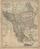
1843. Balkanhalbinsel, Osmanisches Reich, and Griechenland. Versteckte Karten.
2. Turquie d'Europe
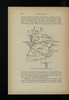
1916. Albanien and Osmanisches Reich. Versteckte Karten.