Search Constraints
You searched for:
Place
Russland
Remove constraint Place: Russland
Map Type
Hydrografische Karte
Remove constraint Map Type: Hydrografische Karte
1 - 9 of 9
Search Results
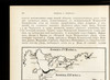
1. Izměnenīja za stolětīe v tečenīi rěki Sury pod Penzoj : Konec XIX věka

1902. Russland and Pensa. Umland and Flusslaufverlegung. 1880/1900. Versteckte Karten.
2. Izměnenīja za stolětīe v tečenīi rěki Sury pod Penzoj : Konec XVIII věka
1902. Russland and Pensa. Umland and Flusslaufverlegung. 1780/1800. Versteckte Karten.
3. Karta urovnja počvennych vod v S. Peterburgě
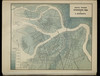
1870. Il'in, A. Russland and St. Petersburg. Grundwasser and Statistik. 1870/1870.
4. Map of the Amur Region
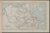
1899. Philip, George and Philip, [Sohn v. G.]. Russland, Sibirien, and Amur. Versteckte Karten.
5. Nevskaja del'ta
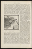
1900. Russland and Newa. Geografie. Versteckte Karten.
6. Položenie počvy S. Peterburga otnositel'no ordinernago urovnja rěki Nevy

1870. Il'in, A. Russland and St. Petersburg. Bebauung and Statistik. 1870/1870.
7. Počvy ozernoj oblasti

1900. Sibircev, K. Russland and Russland (Nord). Geografie. Versteckte Karten.
8. Schematičeskaja karta isčezajuščich ozer Obonež'ja
1900. Russland and Russland (Nord). Geografie.
9. Sěvernyja izlučiny Onežskago ozera
1900. Russland and Onegasee. Geografie.