Search Constraints
You searched for:
Place
Sibirien
Remove constraint Place: Sibirien
Data Type
Raster
Remove constraint Data Type: Raster
1 - 10 of 10
Search Results
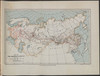
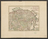
1. Generalis totius Imperii Russorum Novissima Tabula Magnam Orbis terrarum partem a Polo Arctico uso ad mare Iaponicum et Chinae Septentrionalis confinia/exhibens cum via Czaricae nuper Legationis ex urbe Moscua per universam Tartariam ad magnum Chinae Imperatorem ex conatibus Iohannis Baptistae Homanni

Homann, Johann Baptist . Russland, Sibirien, and Mittelasien.
2. Karte der russisch-asiatischen Eisenbahnen [Sibirische Eisenbahnen]
1913. Sibirien. Eisenbahnnetz. 1913/1913. Eisenbahn. Versteckte Karten.
3. Map of the Amur Region
1899. Philip, George and Philip, [Sohn v. G.]. Russland, Sibirien, and Amur. Versteckte Karten.
4. Map of the conquest of Siberia
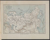
1899. Philip, George and Philip, [Sohn v. G.]. Russland and Sibirien. Eroberung. 1582/1582. Militärgeschichte. Versteckte Karten.
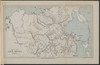
5. Map of the Siberian railway
1899. Philip, George and Philip, [Sohn v. G.]. Russland and Sibirien. Eisenbahnnetz. Eisenbahn.
6. Map showing the communications between the Ob and Yenissei Rivers

1899. Sibirien, Ob, and Jenissei. Flusssystem. Versteckte Karten.
7. Map showing the communications between the Yenissei and Lena Rivers

1899. Sibirien, Lena, and Jenissei. Flusssystem. Versteckte Karten.
8. Map showing the country traversed by Yermak
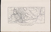
1899. Russland and Sibirien. Eroberung and Ermak, Timofeevič. 1582/1582. Militärgeschichte.
9. Nieuwe kaart van Tartarie. Na de alderlaaste ondekking int ligt gebragt…
Tirion, Isaak. Sibirien, Mittelasien, and China.
10. Plan of the attack on Petropavlofsk

1899. Philip, George and Philip, [Sohn v. G.]. Sibirien, Kamtschatka, and Petropawlowsk-Kamtschatski. Krimkrieg. 1854/1854. Militärgeschichte.