Search Constraints
1 - 8 of 8
Search Results
1. Carte des écoles et églises du vilayet d'Andrinople du sandjak de Tchataldja et de la partie européenne du vilayet de Constantinople (1908)
1919. Vilâyet Edirne, Ejalet Istanbul, and Sandschak. Kirchenbau. 1908/1908. Versteckte Karten.
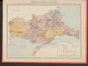
2. Map 13a : Kaza-level administrative map of Tuna and Edirne Vilayets after 1878
2021. Demeter, Gábor and Bottlik, Zsolt. Vilâyet Edirne and Donau-Wilajet. Verwaltungsgliederung. 1878. Ethnografie. Versteckte Karten.
3. Map 14a : Kaza-level ethnographic map of Tuna and Edirne Vilayets after 1831
2021. Demeter, Gábor and Bottlik, Zsolt. Vilâyet Edirne and Donau-Wilajet. Ethnische Gruppe. 1831. Ethnografie. Versteckte Karten.
4. Map 34 : Religious distribution of the population in Tuna and Edirne Vilayets, cca. 1873
2021. Demeter, Gábor and Bottlik, Zsolt. Vilâyet Edirne and Donau-Wilajet. Denomination (Religion). 1873/1873. Ethnografie. Versteckte Karten.
5. Map 35 : Ethnic distribution of the population in Edirne Vilayet, cca. 1873
2021. Demeter, Gábor and Bottlik, Zsolt. Vilâyet Edirne. Ethnische Gruppe. 1873/1873. Ethnografie. Versteckte Karten.
6. Map 36 : Ethno-religious distribution of the urban population in Tuna and Edirne Vilayets, cca. 1874
2021. Demeter, Gábor and Bottlik, Zsolt. Vilâyet Edirne and Donau-Wilajet. Ethnische Gruppe and Stadtbevölkerung. 1874/1874. Ethnografie. Versteckte Karten.
7. Map 44 : Religious distribution of the population in Edirne Vilayet, cca. 1881
2021. Demeter, Gábor and Bottlik, Zsolt. Vilâyet Edirne. Denomination (Religion). 1881/1881. Ethnografie. Versteckte Karten.
8. Map 45 : Ethnic distribution of the population in Edirne Vilayet, cca. 1881
2021. Demeter, Gábor and Bottlik, Zsolt. Vilâyet Edirne. Ethnische Gruppe. 1881/1881. Ethnografie. Versteckte Karten.