Search Constraints
You searched for:
Map Type
Bevölkerungskarte
Remove constraint Map Type: Bevölkerungskarte
License
Public Domain
Remove constraint License: Public Domain
Search Results
51. Karte IV: Panslawistische Karte von Europa

1916. Europa. Panslawismus. Ethnografie.
52. Karte V: Nationalitätenkarte von Europa

1916. Europa. Ethnische Gruppe. Ethnografie.
53. [Lausitz]
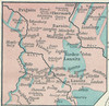
1918. Lausitz. ethnische Gruppe. Ethnografie. Versteckte Karten.
54. [Litauen, Lettland]
1918. Litauen and Lettland. ethnische Gruppe. Ethnografie. Versteckte Karten.
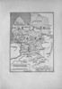
55. Litauisch und Masurisch

1913. Ostpreußen. Litauisch and Masurisch. Versteckte Karten.
56. Ljudnost' selenīj v srednerusskoj černozemnoj oblasti

1902. Russland and Zentralrussland. Bevölkerung. Ethnografie. Versteckte Karten.
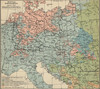
57. Länder- und Völkerkarte Europas

1916. Schäfer, Dietrich . Europa. ethnische Gruppe and Staat. Ethnografie. Versteckte Karten.
58. Materinski jezik građanskog žiteljstva 1910 po upravnim kotarima i gradovima
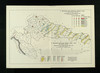
1915. Kroatien and Slawonien. Muttersprache and Statistik. 1910/1910. Ethnografie. Versteckte Karten.
59. Mineralien
1913. Russland / Europäischer Teil. Mineralischer Rohstoff. Versteckte Karten.
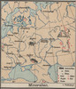
60. Mitteleuropa: Konfessionsgebiete
1912. Mitteleuropa. Denomination <Religion>. Versteckte Karten.