Search Constraints
You searched for:
Map Type
Plan <Kartografie>
Remove constraint Map Type: Plan <Kartografie>
Data Type
Raster
Remove constraint Data Type: Raster
Search Results
41. Plán hradu Krakovce
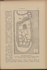
1901. Tschechische Republik, Böhmen, and Burg Krakovec. Hus, Jan. Versteckte Karten.
42. Situationsplan der St. Annen-Kirche
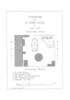
1879. St. Petersburg. Kirchenbau and Evangelische Kirche. 1879/1879. Versteckte Karten.
43. Stations de Démirly

1916. Griechenland and Paleofarsalos <Stavrós Thessalien>. Eisenbahnverkehr and Verkehrsknotenpunkt. Eisenbahn. Versteckte Karten.
44. The Plitvica Lakes
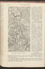
1913. Kroatien and Plitvicer Seen. Versteckte Karten.
45. Tichvinskīj kanal
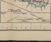
1900. Il'in', N. Russland and Russland (Nord). Schifffahrtskanal. Infrastruktur. Versteckte Karten.
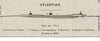
46. Trikkala; Vélestino [Teilkarte Belestinon]
1916. Griechenland and Belestinon. Gleisanlage and Bahnhof. Eisenbahn. Versteckte Karten.
47. Trikkala; Vélestino [Teilkarte Trikala]

1916. Griechenland, Trikala, and Belestinon. Bahnhof and Gleisanlage. Eisenbahn. Versteckte Karten.
48. [Umgebungsplan] Jamskoj rynok
1910. Russland and St. Petersburg. Marktplatz and Adressbuch. 1910/1910. Versteckte Karten.
49. [Umgebungsplan] Kruglyj rynok

1910. Russland and St. Petersburg. Marktplatz and Adressbuch. 1910/1910. Versteckte Karten.
50. [Umgebungsplan] Litovskīj rynok
1910. Russland and St. Petersburg. Marktplatz and Adressbuch. 1910/1910. Versteckte Karten.