Search Constraints
You searched for:
Map Type
Politische Karte
Remove constraint Map Type: Politische Karte
Project
gei digital
Remove constraint Project: gei digital
Map Scale
25000000
Remove constraint Map Scale: 25000000
1 entry found
Search Results
1. Europa, Staatenkarte
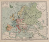
1904. Europa. Versteckte Karten.