Search Constraints
You searched for:
Map Type
Politische Karte
Remove constraint Map Type: Politische Karte
Map Scale
5000000
Remove constraint Map Scale: 5000000
1 entry found
Search Results
1. Mitteleuropa Übersicht der politischen Verhältnisse und Hauptverkehrswege
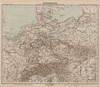
1888. Mitteleuropa. Verkehrsnetz. Infrastruktur. Versteckte Karten.